Sugar Island
Funding Agency: U.S. Environmental Protection Agency, administered through the National Oceanic and Atmospheric Administration (NOAA)
Project Budget: $18,600,000
Start Date: August 2017
End Date: November 2022
Sugar Island is an uninhabited, 29-acre island at the mouth of the Detroit River near Lake Erie. It is entirely owned by the U.S. Fish and Wildlife Service (USFWS) as part of the Detroit River International Wildlife Refuge. This area of the Detroit River serves as one of the most important spawning areas for western Lake Erie. Significant, positive recreational and economic impacts are anticipated because of this project that will enhance quality of life for southeast Michigan and northwest Ohio and further strengthen the Great Lakes fishery, worth more than $7 billion annually.
In the early part of the 20th century, Sugar Island hosted a resort park that included a large roller coaster, merry-go-round, bathing beach and dance pavilion. Access to the island was by steam ferry, such as the SS Tashmoo. By the 1940s, the park fell into disrepair and various plans for revitalization never advanced. In 2012, Sugar Island was purchased by the USFWS with Great Lakes Restoration Initiative (GLRI) funding for inclusion in the Detroit River International Wildlife Refuge.
The island has reverted to a natural state that contains remnants of valuable upland and aquatic, shoreline habitat. The Detroit River is a known migration corridor for many birds and insects, and Sugar Island is a stopover site during migration for a wide range of species. Forests, like that on Sugar Island, are especially important for dozens of species of neotropical migrant passerines. Heavy use of the island in spring and fall by sparrows, kinglets, warblers, vireos, orioles and tanagers is frequently observed. Hundreds of thousands of blue jays annually travel over this area around western Lake Erie. As a result, the migration of raptors is monitored and well-documented to utilize this concentration of migrant songbirds as prey. These raptors include sharp-shinned hawk, Cooper's hawk, northern goshawk, broad-winged hawk, and red-shouldered hawk. The sand beaches are used for hunting by merlin, red-tailed hawk, bald eagle, and northern harrier.
Fish in the shallow waters around Sugar Island are diverse but not plentiful. Species include largemouth, smallmouth and white bass, bowfin, bullhead, gar, pike, rock bass, blue gill, pumpkinseed, emerald shiner and yellow perch. Of note is the presence of channel darter, a Michigan endangered species.

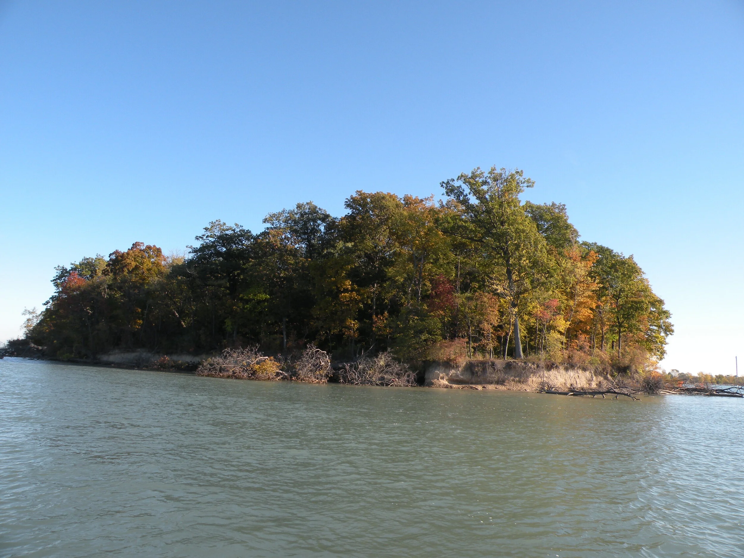
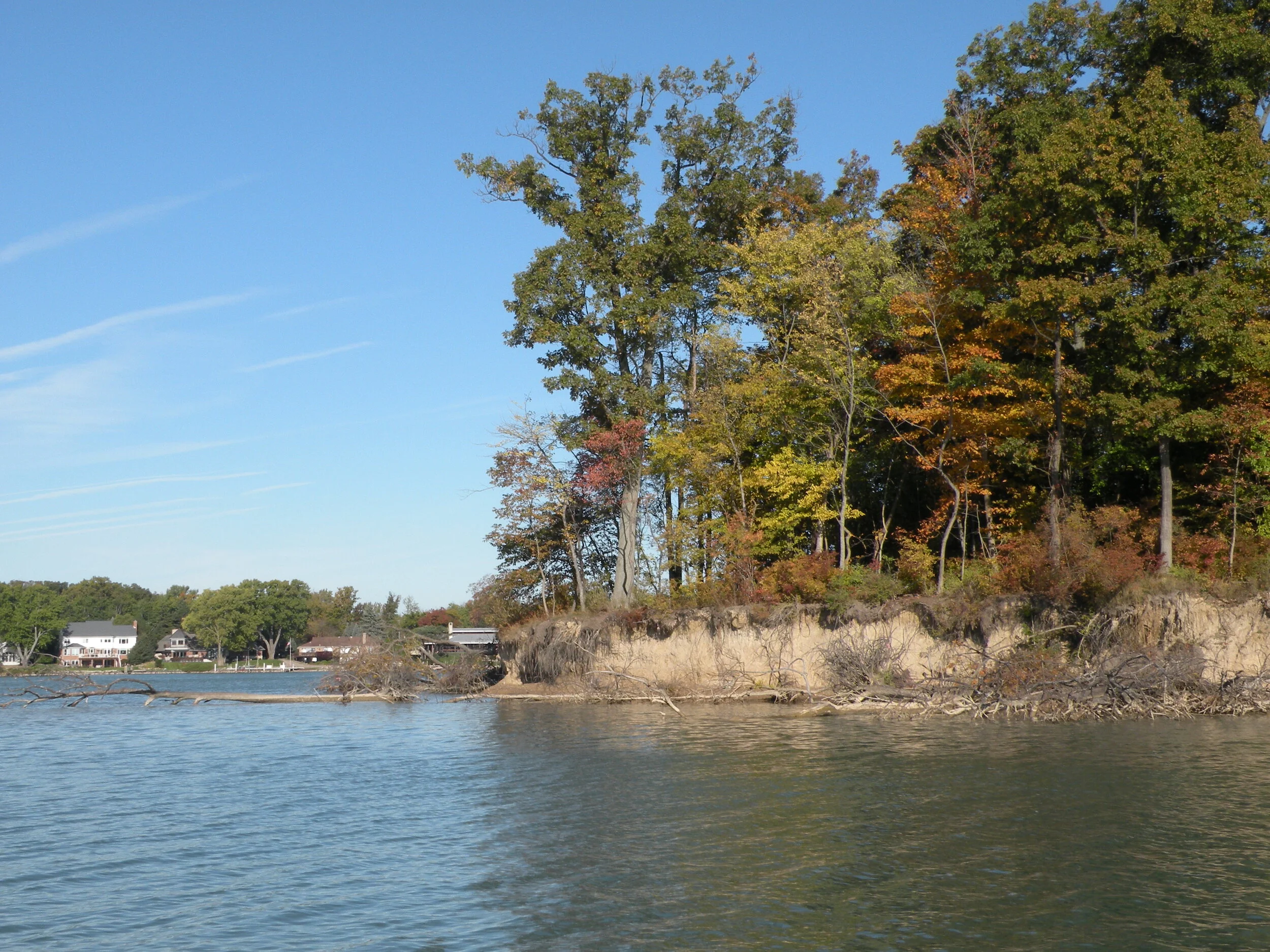


Project Scope: Sugar Island is exposed to high wind and wave action resulting from its southern exposure to western Lake Erie, which accounts for the loss of approximately 10% of the island to erosion in recent decades. This project explored the ecological value and feasibility of controlling shoreline erosion while enhancing fish and wildlife habitat. A science-based feasibility study was conducted with assistance from SmithGroup and input from fisheries and wildlife scientists from the United States Geological Survey (USGS), Michigan Office of the Great Lakes (OGL) and the USFWS. Construction of protective shoals around the island's south end along with erosion control measures on the south shore were the primary ideas considered in this investigation.
Projects of this magnitude and importance require an understanding of the riverbed from both structural (load bearing) and sediment character (potential contaminants and sediment transport) standpoints. Consequently, this project included an evaluation of riverbed sediments near the island. Furthermore, analysis of the island's shoreline geology, river flow characteristics surrounding the island, and existing vegetation on the island and in the nearshore were conducted to help inform potential design alternatives.
Regarding the hydrology around the island, hydrodynamic modeling of existing wave, wind and current conditions was conducted. A conceptual plan with several barrier shoals wrapping the island’s south end was inserted into the model to understand what impact the islands would have on current and waves and their effect on the eroding south shore. In addition, this mathematical modeling was important to predict any changes in flow, nearshore dynamics, sediment transport, erosion rates, etc. that may result from the proposed shoals. Findings from this investigation helped inform two conceptual, restoration design alternatives. The project team chose to incorporate features from both alternatives into a final concept, which was vetted to the public and received tremendous support. This completed the feasibility and design phase of the project.
NOAA continued funding the Sugar Island project, with a grant to FDR, to further develop the plan and to conduct additional hydrodynamic modeling to verify feasibility of any changes to the initial concept plan. The funding supported final engineering, permitting, and construction documents as well. SmithGroup assisted FDR, USFWS and other project stakeholders with this work.
Following an open bidding process, E.C Korneffel Company was selected to construct the project. With work beginning in summer of 2021, completion is anticipated by the end of 2022.
Project Outputs/Outcomes: This project established practical limits of upland, wetland and submergent habitat that can be restored within the degraded and eroded areas on and adjacent to Sugar Island’s southerly end. 2,700 linear feet of coastal shoreline and 21 acres of coastal wetland will be restored, enhanced, and protected. Up to 2.5 acres of upland habitat will be restored and enhanced with native plantings.
Project Data
These data and related items of information have not been formally disseminated by NOAA, and do not represent any agency determination, view, or policy.